
Archived GIS Snippets
Published in 2013
Permanent URL
42 Maps that Will Change How You Think About the World
by eric limer
Aside from just telling you where you are, or letting you point our where you want to be, maps can do a fantastic job of recontextualizing everything you think you know about the world. You probably know that already, but here's a run-down of maps that do it well.
Vlogbrothers does a good job of spinning through some of the more clever map visualizations out there, a few of which we've seen, but even more we haven't. It's just a quick, whirlwind tour, but you can find links to all the maps in full on the YouTube page. In the meantime, sit back and let your perception of the world shift around you. [Vlogbrothers
first published week of: 09/23/2013
Permanent URL
466 Mapping APIs: Google Maps, Bing Maps and Foursquare
by kevin sundstrom
Our API directory now includes 466 mapping APIs. The newest is the 1Map API. The most popular, in terms of mashups, is the Google Maps API. We list an amazing 2454 Google Maps mashups. Below you’ll find some more stats from the directory, including the entire list of 466 APIs.

On the mashup side, we list 2671 mashups. We listed letsgo.io on April 24th 2013.
For reference, here is a list of all 466 APIs: continued…
first published week of: 05/06/2013
Permanent URL
5 Tools For Analyzing Location Data from Social Media
by stephanie miles

The volume of data available through social media overwhelms marketers of all sizes, including large brands with hundreds of outposts. Whereas it might be possible for a merchant with a single location to manually monitor the tweets, reviews, and photos being posted about his business each day, that kind of personal attention to detail is virtually impossible for larger brands.
A handful of hyperlocal vendors are offering tools that brands can use to make sense of the local data coming through social media. With geo-targeting capabilities that allow merchants to infer location from the context of a user’s message, brands, retailers, and other large chains can see where relevant conversations are happening and measure the influence of their most loyal customers. Here are five examples of platforms that marketers can use to make sense of the location-specific data coming from social media. continued…
first published week of: 11/11/2013
Permanent URL
5 Valuable Google Maps Tips and Tricks
by Sara Roncero-Menendez
Google Maps used to only allow you to map out directions between two locations. Now, plan out a whole route in one go. When you input directions, click the plus sign directly under the directions to add another stop. Add as many as you want and plan the ultimate day, all in one sitting. continued…
first published week of: 12/16/2013
Permanent URL
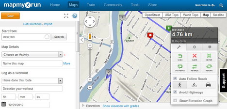
9 Online Tools to Create Custom Maps and Get Directions
Thanks Google Maps for being one of the pioneers in the development of web-based mapping. It makes us realize the importance of online maps in our daily lives such as getting right direction to the destination, jogging, bike riding and traveling. With the advancement of the smartphone and tablet computers, finding location of destination becomes easier through GPS navigation and mapping apps.
Instead of teaching you tricks to effectively use Google Maps, we chose to introduce you 9 free tools that’ll help you to become an expert map-maker! With these web apps, you can easily plan a map for travelling, generate company location map or explain a route to someone. I hope you’ll find them helpful.
first published week of: 01/07/2013
Permanent URL
eSpatial launches free edition of mapping software
eSpatial announced a free upgrade to its flagship software, also called eSpatial. The product update features significant capability enhancements including Territory Mapping.
eSpatial believes that the new tool will help companies and organizations manage sales teams or representatives more effectively, reduce costs and highlight potential opportunities.
eSpatial users can now design, refine and label their own unique territories according to country, state or zip and quickly generate territory management reports, highlighting the spread and breakdown of resources in a given region.
Other features completely new to eSpatial following this upgrade are:
- Data editing on a map from within the eSpatial application
- The ability to search, visualize and generate maps based on nearby locations using eSpatial’s Within Distance and Nearest Neighbor functionality.
The update is freely available to all existing eSpatial users. Alternatively, new users can avail of a free 7-day trial, which allows full access to the eSpatial application and its latest features.
first published week of: 03/18/2013


 ♦
♦ 